
Drone Photography for a Wooded Pebble Beach Land Listing
Professional aerial real estate photography near Carmel Beach and the Monterey Peninsula coastline
Returning client Kyle recently contacted me about a land listing in Pebble Beach near Carmel Beach. With the property almost completely covered by trees and very limited access from the ground, aerial drone photography was an excellent way to capture the setting and show prospective buyers where this property sits within one of the most scenic areas of the Monterey Peninsula.
From Realtor Headshots to Drone Photography in Pebble Beach
Earlier this year, Kyle came to my Pacific Grove photo studio for professional realtor headshots as he was starting his new career in real estate. It was great to hear from him again, this time needing something completely different, drone photography of a vacant land listing in Pebble Beach!
Kyle described the property to me on the phone as being very tree covered and with a lot of vegetation so upon arrival it was easy to see that aerial drone photos would be by far the best way to represent the lot. Kyle asked can you tell the elevation of the drone in the air, and I said yes, so I flew at 40 feet to show what the view would be if the buyer built a 3-story house. You would have some ocean views! I feel this is a powerful way to help prospective buyers have a sense of what the views can be.
Also from the air I was able to show the tree covered property in relation to the surrounding neighborhood, nearby golf course, Carmel Beach, and the Pacific Ocean. Even though I have photographed this area many times before, seeing it from a new angle never gets old, especially with such an impressive coastline right beside it.
Thank you Kyle for choosing me as your drone pilot and it is great to now be able to help with your listings as well as your headshots!
See the Pebble Beach Property Listing
It is great to see these aerial drone photographs now being used by realtor Kyle Murphy to market this unique Pebble Beach property. You can view the listing on Zillow to see the photos in use and learn more about the property itself.
VIEW PROPERTY LISTING ON ZILLOW
Show More of Your Real Estate Listing From Above
Some properties are difficult to photograph from the ground, especially wooded lots, vacant land, and homes surrounded by mature trees. Professional drone photography provides a wider perspective that can help prospective buyers understand a property's location and surroundings. If you have a unique real estate listing in Pebble Beach, Carmel, Monterey, or elsewhere on the Monterey Peninsula, I can help you show it from above.
At the Pebble Beach Property With Realtor Kyle
A closer drone view showing just how wooded this vacant land listing really is
I also made this drone photo of Kyle and me standing beside the real estate sign at the property. It gives you a good idea of just how much vegetation there is and why photographing this listing from the ground was such a challenge. Even standing right there, we could barely see into the property! This is why I wanted to get the drone up in the air and make photographs that show the much bigger picture of where this wooded lot is located in Pebble Beach.
Aerial Real Estate Photography Near Carmel Beach
Drone views of a wooded Pebble Beach property and its surrounding neighborhood, golf course, and coastline
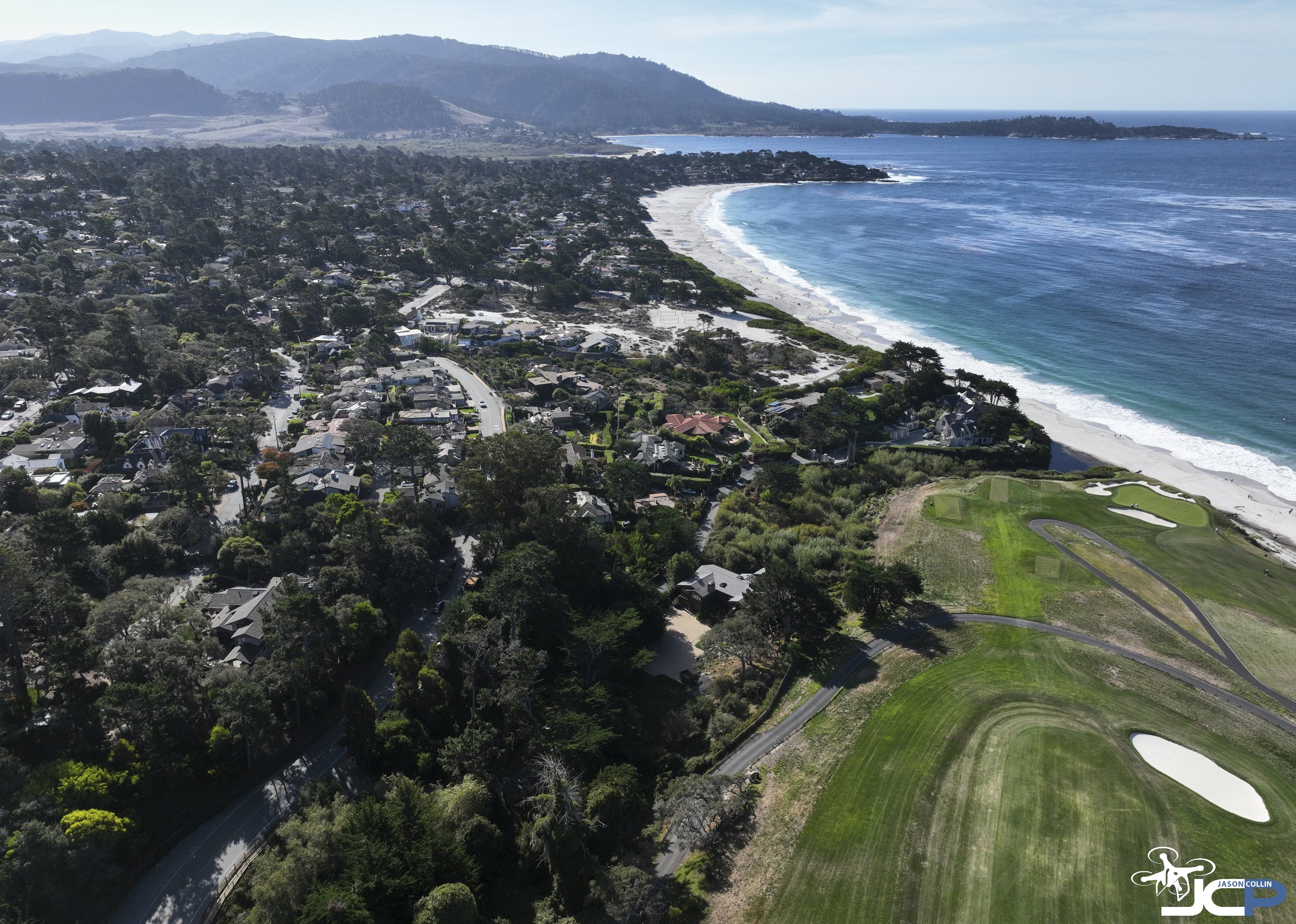
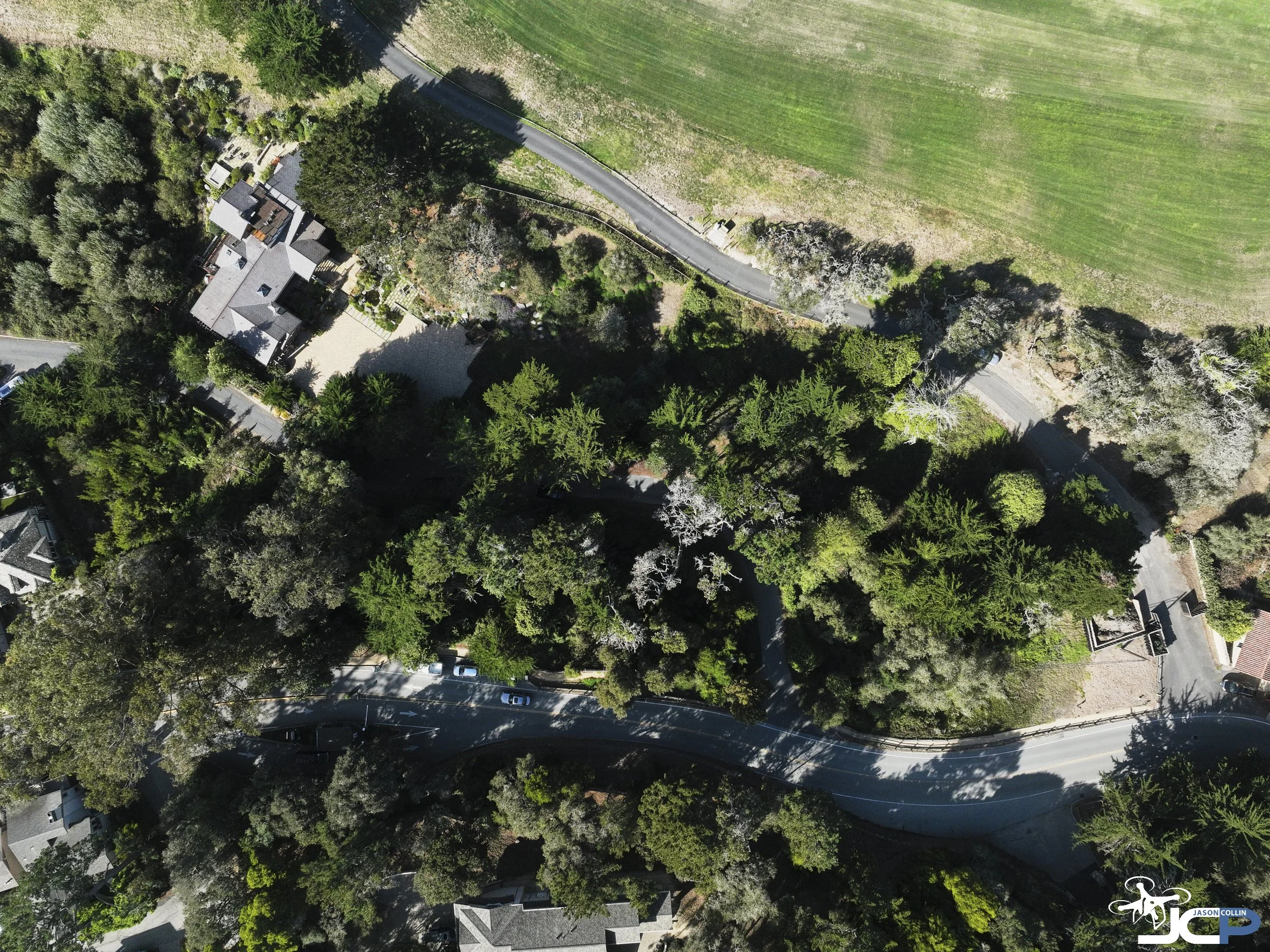
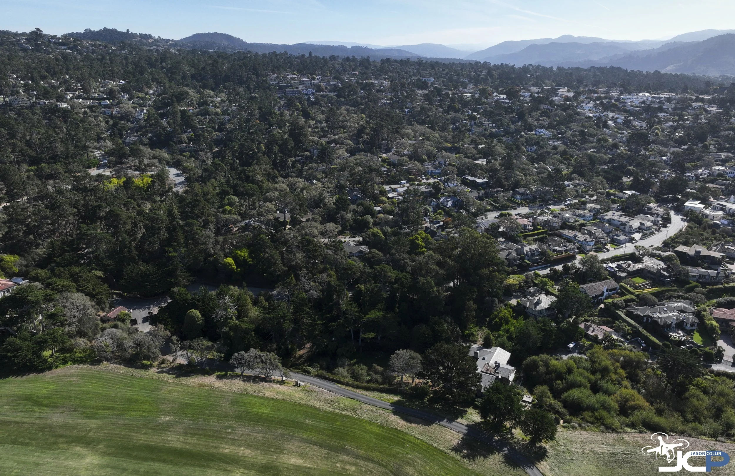
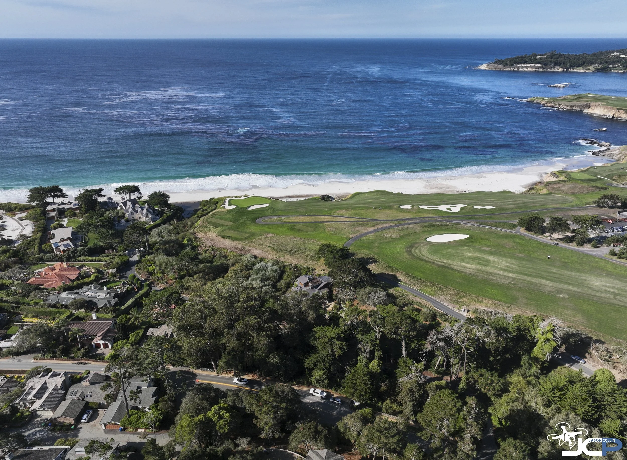
What makes aerial photography especially useful for this type of listing is the ability to put the property into context. With so much tree coverage, traditional ground photography could only reveal a small part of the setting. These drone photographs provide a much broader view of the surrounding area, including the nearby coastline, golf course, and residential streets.
For prospective buyers who may not be familiar with Pebble Beach, this additional perspective can be a helpful part of understanding the property's location before visiting in person.
Why Drone Photography Is Valuable for Vacant Land Listings
Professional aerial photographs help real estate agents market wooded lots, undeveloped land, and unique coastal properties
Marketing vacant land presents a different challenge than photographing a finished home. Without rooms, architectural features, or landscaping to showcase, the property's location and surrounding environment often become the most important things to communicate to potential buyers.
This is especially true in areas like Pebble Beach and Carmel, where heavily wooded lots, winding roads, and unique coastal settings can make it difficult to understand a property through traditional ground photography alone.
Professional drone photography can provide several advantages for real estate agents and brokers:
Show location and surroundings: Help buyers see how a property fits into its neighborhood, including nearby roads, homes, and natural features.
Photograph difficult to access properties: Capture useful aerial views of wooded lots, undeveloped land, and properties with limited ground access.
Highlight nearby amenities: Show the broader setting, including beaches, golf courses, and other notable features when appropriate.
Create stronger real estate marketing materials: Use high resolution aerial photographs for MLS listings, brokerage websites, digital advertising, and property presentations.
Provide additional perspectives: Combine closer overhead photographs with wider scenic images to give potential buyers a more complete understanding of the location.
For some listings, aerial photography may be the primary visual approach. For others, it works best alongside traditional exterior and interior real estate photography.
As a Pacific Grove based professional photographer and FAA Part 107 certified drone pilot, I provide aerial photography for real estate professionals throughout Pebble Beach, Carmel, Monterey, and the surrounding Monterey Peninsula.

Real Estate Drone Photography in Pebble Beach and Monterey
Professional aerial photography for realtors, brokers, property owners, and land listings throughout the Monterey Peninsula
Are you a real estate agent preparing to list a wooded lot, vacant land, coastal property, or luxury home in Pebble Beach, Carmel, Monterey, Pacific Grove, or elsewhere on the Monterey Peninsula?
I provide professional aerial drone photography that helps show a property's setting, location, and surrounding features from perspectives that traditional ground photography cannot capture. Whether you need aerial photographs for a vacant land listing, a residential property, or a unique real estate marketing project, I can help.
I have been a professional photographer since 2009 and am an FAA Part 107 certified drone pilot based in Pacific Grove. I work directly with real estate professionals and businesses to create photographs that are ready to use for online listings, websites, and other marketing materials.
Contact me with the property location and details of your upcoming listing. I would be glad to discuss the photography options that would work best for your project.
Professional real estate drone photography in Pebble Beach, Carmel, Monterey, and throughout the Monterey Peninsula helps real estate agents, brokers, and property owners showcase vacant land, wooded lots, coastal properties, and residential listings with high resolution aerial photographs that communicate location, surroundings, and property context.